




LatLonGO

Description of LatLonGO
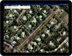
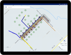
LatLonGO ব্যবহারকারীদের কোনও মোবাইল ট্যাবলেটের সাথে জিআইএস তথ্য বিতরণের জন্য একটি সিস্টেম সরবরাহ করে। সহজ ব্যবহারকারীর ইন্টারফেসটি মোবাইল কর্মীদের জন্য আদর্শ, যাদের অনলাইন বা অফলাইন উভয়েরই কর্পোরেট তথ্য আপ টু ডেট কপি পাওয়া প্রয়োজন।
LatLonGO অনেক জিআইএস ফরম্যাট থেকে তথ্য প্রক্রিয়া এবং এটি কোন ইন-হাউস বা বহিরাগত (মেঘ) সার্ভার থেকে পরিবেশন করা Smallworld, ArcGIS এবং QGIS প্রসেসটি নেটিভ (WYSIWYG)। আমরা আইটি-আইটি বিশ্বব্যাপী 24-ঘন্টার সময়-জোন সাপোর্ট এবং ব্যাক-এন্ড আর্কিটেকচারের বাস্তবায়ন এবং সহায়তাের জন্য একটি স্থানীয় অংশীদার নেটওয়ার্ক সরবরাহ করে।
কী পণ্য বৈশিষ্ট্য এবং উপকারিতা
* 100% অ্যাপ্লিকেশন উপলব্ধতা অনলাইন বা অফলাইন
* অফিস জিআইএস পরিবর্তনের ক্রমবর্ধমান মোবাইল আপডেট
* রেডলাইন ব্যাক-টু-অফিসের বিজ্ঞপ্তিগুলি
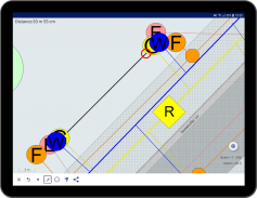
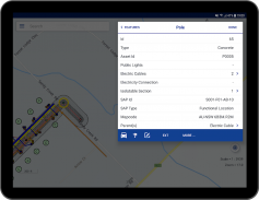
* সম্পাদনা দক্ষতা (নতুন বৈশিষ্ট্যগুলি তৈরি করুন, বৈশিষ্ট্যগুলির বৈশিষ্ট্য এবং জ্যামিতি সম্পাদনা করুন, বৈশিষ্ট্য মুছুন)
* সীমাহীন দৃশ্য স্কেলিং; কার্টোগ্রাফিক বিস্তারিত কোন ক্ষতি
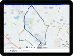
* এখানে মানচিত্রের ব্যবহারকারীদের ডেটা প্রদর্শন করে (অথবা ব্যবহারকারীদের নিজস্ব ল্যান্ডবেসে)
* ব্যবহারকারীদের মোবাইল ডাটাবেসে একক অনুসন্ধান
* অত্যাধুনিক তথ্য সংকোচনের এবং এনক্রিপশন
* মোবাইল সার্ভার লাইসেন্স এবং প্লাস Smallworld জিআইএস, ArcGIS এবং spatialNET® এক্সট্রাক্টরস
* এসএপি সার্টিফাইড
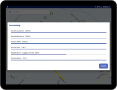
কিছু বিক্ষোভের ডেটা অ্যাক্সেস করতে, অ্যাপ্লিকেশন প্রথমবার শুরু হয় যখন এই বিবরণ লিখুন
সার্ভার: demo.latlongo.com
ব্যবহারকারীর নাম: ডেমো
পাসওয়ার্ড: latlongo


